No time to hike the Appalachian Trail? Try these 12 easy section hikes

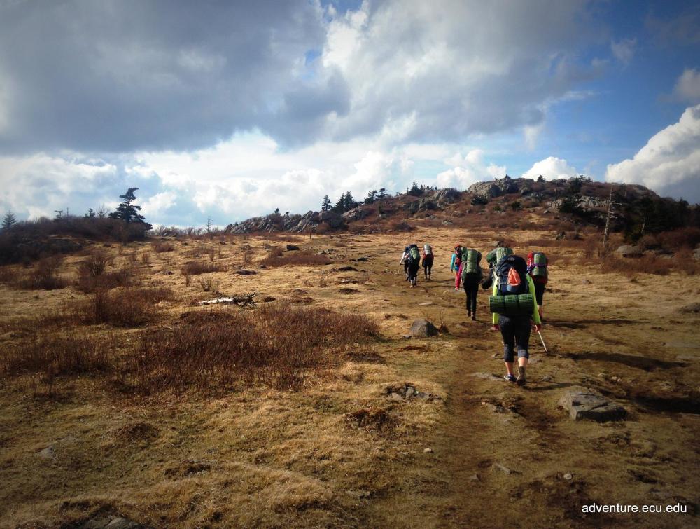
Students from East Carolina University's Honor College hiking on the Appalachian Trail.
ECU Honors College
Don't have time for a thru-hike on the Appalachian Trail? That's ok.
If you are looking for an epic trail to hike, there isn't one more worthy than the legendary Appalachian Trail. Initiated by Benton MacKaye, a founder of The Wilderness Society, this trail has become a classic wilderness experience. It extends over 2,000 miles through 14 Eastern states, so a "thru-hike" can take several months.
Don't have time for a thru-hike? You can witness the many splendors the Appalachian Trail offers in small chunks. Whether you have an afternoon or a couple weeks to delight in a wild journey, there are many paths for you to explore.
Here are our suggestions on some not-to-be-missed sections of the trail.

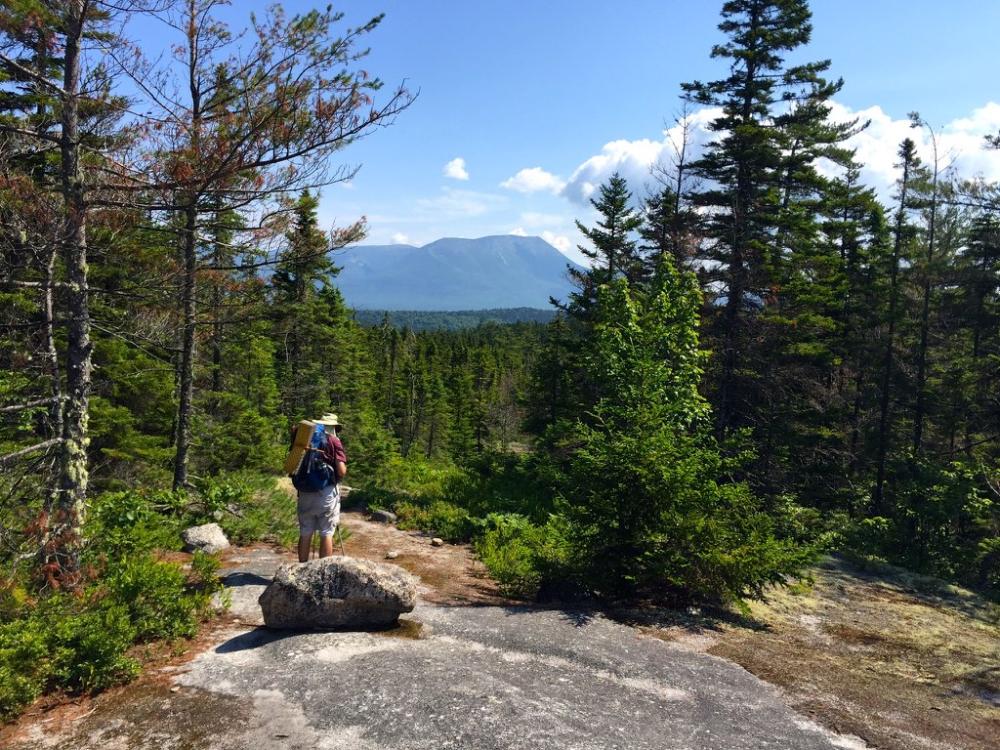
view of Katahdin, from Rainbow Ledges, 20.9 miles via the Appalachian Trail.
John Hayes, Flickr
1. Springer Mountain, Georgia 75 miles (eight days)
This part of the trail at the southern end of the A.T. may not get as much attention as others, but it is no less impressive. From northern Georgia to southern North Carolina, forests of mountain laurel lead to grassy peaks which drop into quiet, shady valleys of oak. The Benton MacKaye Trail is less than a hal-mile from Springer's summit and is actually the original A.T. footpath. Although this section is a longer journey, it is generally the first one for thru-hikers who prefer to enjoy milder southern climates in spring and can begin to fully prepare for the most challenging sections at the northern end.
2. Nantahala Mountains, North Carolina 29-mile hike (three days)
Although this section features some of the best fire tower views in the East, it remains one of the more solitary jaunts. From Winding Stair Gap at US 64, head north to pass through the Nantahala Gorge, Little Tennessee River Valley and Fontana Lake before arriving at the Nantahala Outdoor Center. Blanketing this crest of the Nantahala Range and Cowee Ranges is the Southern Nantahala Wilderness, which also has a few side trails for shorter trips, like Lower Ridge Trail (4.1 miles), Big Indian Loop (8 miles) and Beech Gap (2.8 miles). Our SAWS Wilderness Conservation Corps worked on tread restoration this summer near Beech Gap.
3. Great Smoky Mountains National Park, Tennessee (four days)
As the country's most visited national park, this is a classic Southern backpacking trip. Reservations are required for shelters and campsites, and weekdays are generally less crowded. Hiking routes travel along ridges and streams, offering fire tower vistas, icy swimholes and a climb to the highest point on the trail at Clingman’s Dome (6,600 feet). Trails are steeper, longer, and higher here than in Shenandoah National Park. Weather in spring can include rainstorms, snowstorms and even hailstorms.
4. Iron Mountain Gap to Cross Mountain, Tennessee 17 miles (overnight)
Tennessee's Iron Mountain ridgeline careens through the wild Cherokee National Forest. You will encounter an apple orchard near Weedy Gap and may stay at the Roan High Knob Shelter, the highest elevation shelter on the Appalachian Trail. This area has been improved in the past by our Southern Appalachian Wilderness Stewards' (SAWS) BOOT Crew and Wilderness Conservation Corps.
5. Mau-Har Loop, Virginia 14 miles (overnight)
With plenty of scenic views and 40-foot waterfalls coupled with swimming holes, this could be the ideal overnight hike. But such delights require a more difficult hike - up about 7,000 rocky feet. Hikers will pass through Three Ridges Wilderness and observe amazing vistas like Hanging Rock Vista on Bee Mountain, Chimney Rocks Vista on Three Ridges mountain and Flat Rock Vista. You can set up camp right by a stream for easy access to water too. Details on the route can be found here.
6. Shenandoah National Park, Virginia 100 miles (ten days)
Although this is a longer journey, it is the easiest part to hike, presenting stunning views of the Blue Ridge Mountains and the Shenandoah Valley as it runs parallel to Skyline Drive. You can stop into Big Meadows Lodge, spot wildlife like black bears and white-tailed deer and stay overnight in a hut. With less climbs, lots of nearby shops and hundreds of miles more of additional side-trails in the park, this section may be the ideal lengthy one for beginners.

Backpacking through Shenandoah National Park.
Monica Singleton
7. Blue Mountains, Pennsylvania 40 miles one way (four days)
Blue Mountain's ridge offers glorious views of Pennsylvania's farm landscapes at numerous points of interest including the Cliffs, Bake Oven Knob, and the notable Pinnacle. At the heart is Hawk Mountain, known for hosting thousands of migrating raptors every fall, and an excellent day trip for Philadelphia-area Wilderness lovers. The section from Port Clinton to Lehigh GapBreak has five designated shelters and campsites if you're planning a multi-day adventure, or it can be hiked in shorter parts.
8. Delaware River, New Jersey/Pennsylvania 15.9 miles one-way (two days)
The Kittatinny Ridge towers over a thousand feet above the Delaware River, offering rich views of the area. Dip your toes into Sunfish Pond, the southernmost glacial lake on the A.T., or take a side trip to Mount Tammany. There are over a dozen hikes off the A.T out of the hundreds of miles of trails in the Delaware Water Gap National Recreation Area, but of course none compare to the A.T. If you want to get a slice of "trail magic," plan to hike this section in June, when most thru-hikers are passing through and can regale you with their tales of awe.
9. Anthony's Nose, New York 2.2 miles round-trip
The A.T. reaches its lowest point where it crosses the Hudson River, just before a rugged climb up Anthony's Nose. This is a short but very steep section of the trail, able to be hiked in a single day or afternoon. For a side trip, the 3.7-mile Camp Smith Trail connects the A.T. to panoramic views, including of the faraway skyline of New York City.
10. Taconic Highlands, Massachusetts 16.9 one way (two days)
This stretch of the trail, from Salisbury to Jug End (pictured at left), winds through old-growth forest, by waterfalls and over Mount Everett. You can camp at one of the eight designated shelters or camping areas. If you want a shorter glimpse of this area, you can access dayhikes from Route 41 in the Housatonic Valley, including the six-mile Race Brook Falls Trail. If you want a lengthier journey, this area also hosts the long-distance Taconic Crest and the Taconic Skyline trails.
11. Presidential Range, New Hampshire 88 miles (nine days)
By contrast, this section is one of the most difficult, but efforts are rewarded by some of the most beautiful surroundings. The White Mountain National Forest (pictured at right) is known for the nation’s greatest network of hiking trails which boast the famous Mount Moosilauke, Mount Washington, and rugged Kinsman range. Proper preparation is vital as some of these areas are tundra. As you pilgrimage from Kinsman Notch to Gorham, you will pass dramatic vistas of valley lakes as well as six huts available for rest.
12. Best 30 of the 100-mile Wilderness, Maine 29.9 miles one way (three days)
Starting at Monson, Maine, the A.T. careens through its esteemed 100-Mile Wilderness, the longest stretch that doesn’t cross a paved road. The first 30 include the 60-foot Lower Wilson Falls, sugar maple forests, rocky rivers, and panoramic views of the Barren-Chairback Range. Four shelters and numerous campsites offer plenty of places to stay overnight. This stretch ends a short distance from Gulf Hagas, a slate gorge filled with waterfalls. Go in late summer to avoid bugs, or plan for a nine to 12 day adventure to experience the entire span.
Communities at the heart of climate action
Great Dismal Swamp an irreplaceable hub of Black and Indigenous history
M. Reed, NPS Natural Resources, Flickr
House votes to protect millions of acres of wilderness and other public lands in sweeping legislation
Darryl Vigil via Missy Adventures, Flickr
Taking public lands back from polluters
Mason Cummings.


