What "Energy Dominance" could look like for the Arctic Refuge
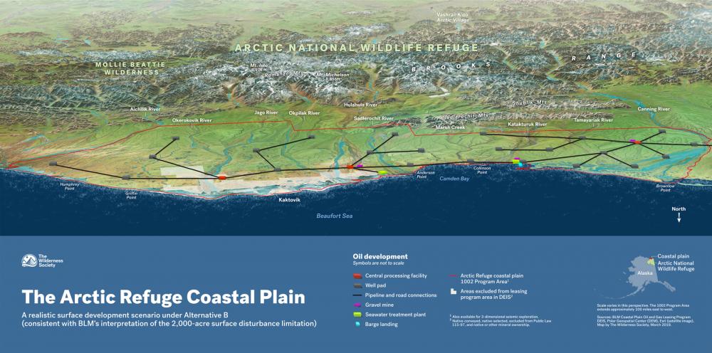
Map shows potential drilling outcome under draft EIS
This map shows what drilling could look like under the current U.S. Bureau of Land Management draft environmental impact statement. The oil industry and its congressional allies claim the development footprint would be only 2,000 acres, but that is terribly misleading. Drilling on the coastal plain would wreak havoc on the environment and the Porcupine Caribou Herd. The draft environmental impact statement failed to include visual depictions of the foreseeable extent and locations of development. This omission makes it difficult for the public to understand that oil companies would be allowed to create a sprawling web of infrastructure across virtually the entire coastal plain.
Created through analyzing the approaches permitted under the environmental impact statement, this map is the first visual representation of what drill rigs across 2,000 acres of the coastal plain could look like under BLM’s Alternative B. If America pursues the Trump administration's "energy dominance" agenda, this is what it would mean for the Arctic Refuge.
Download full map (PDF)

