Article
North Cascades Wilderness Map
As part of our North Cascades Initiative, The Wilderness Society has developed a series of maps to help people explore and experience a variety of rewarding hikes and sights in the North Cascades.
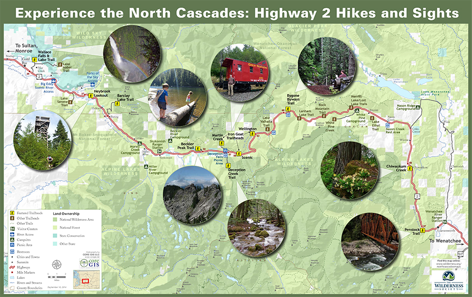
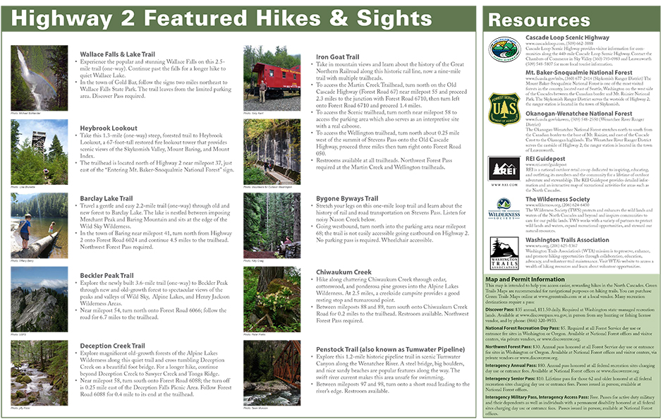
Experience the North Cascades: Highway 2 and 20 Hikes and Sights
The Hikes and Sights maps are intended to guide travelers along Highway 2 (Steven’s Pass) and Highway 20 (North Cascades Highway) to family-friendly, easy hikes and sights along two of the most scenic and traveled driving routes in the North Cascades.


View and save PDF version here

View and save PDF version here
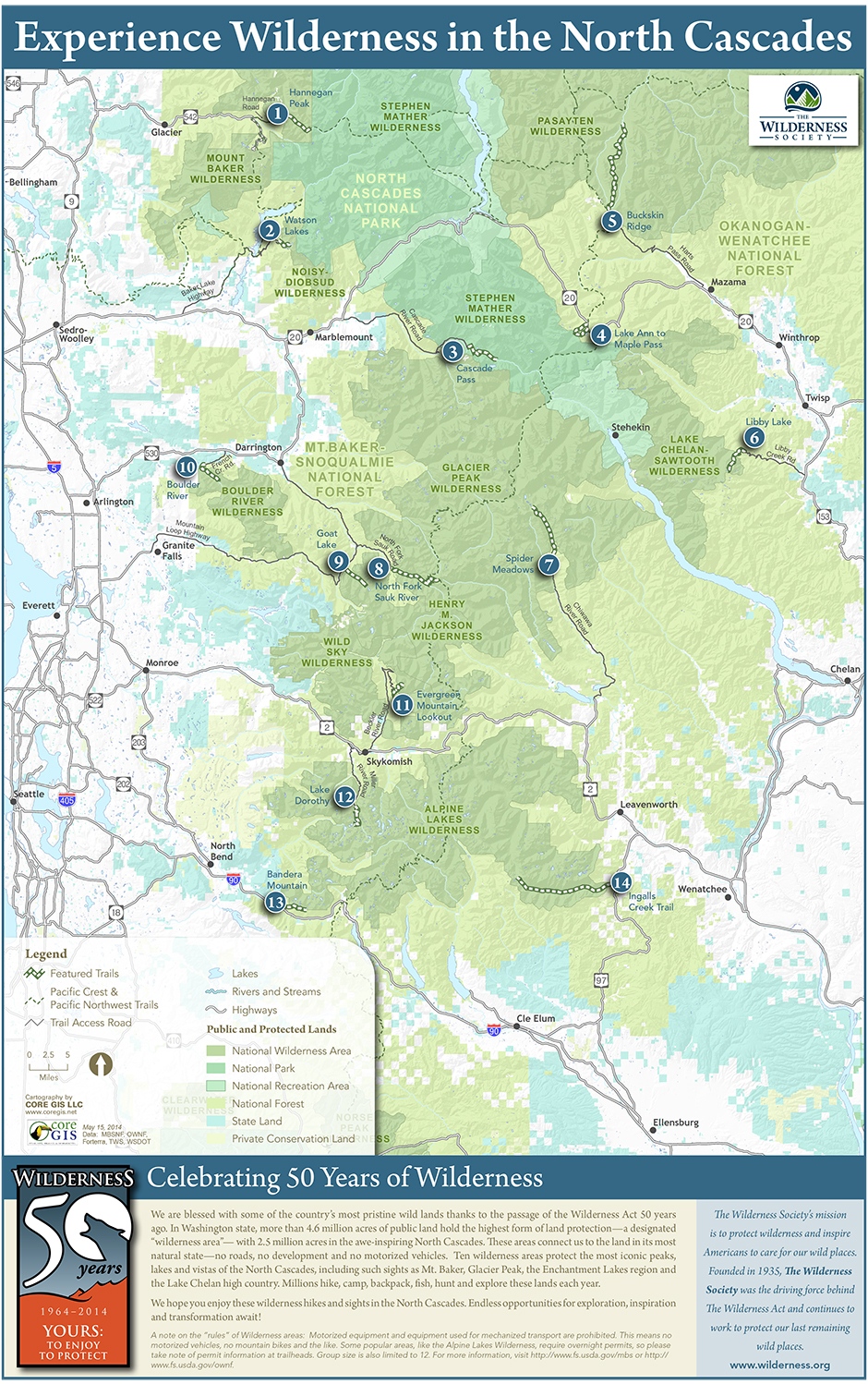
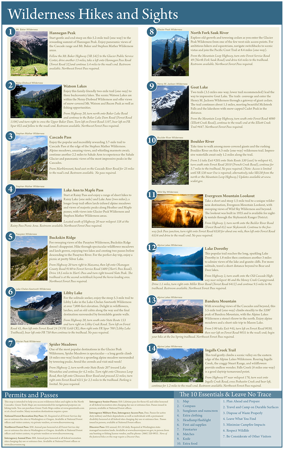
Experience Wilderness: 14 Wilderness Hikes
The Wilderness Society developed a special 50th anniversary map of must-do wilderness hikes, featuring 14 incredible hikes in the 10 wilderness areas of the North Cascades.


View and save PDF version here
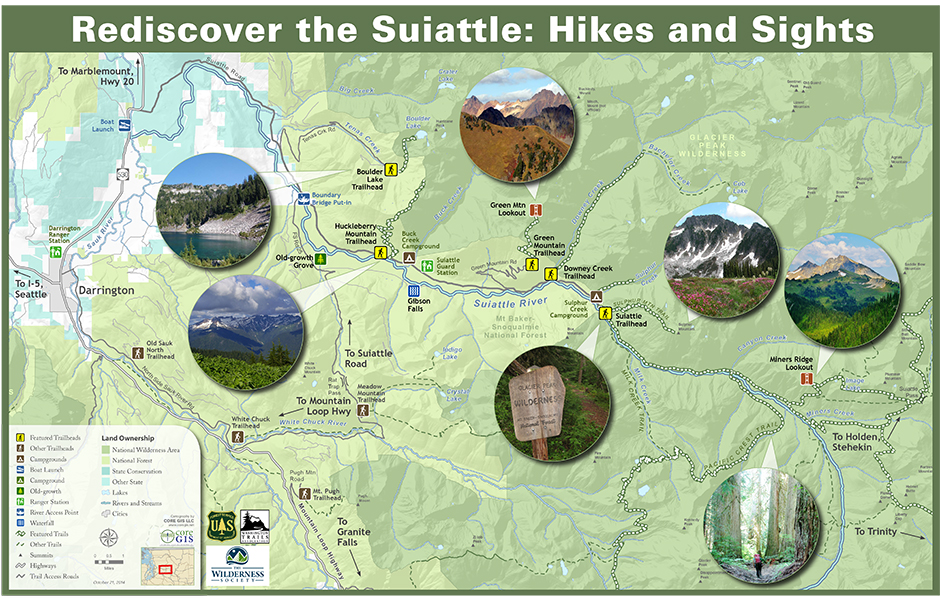
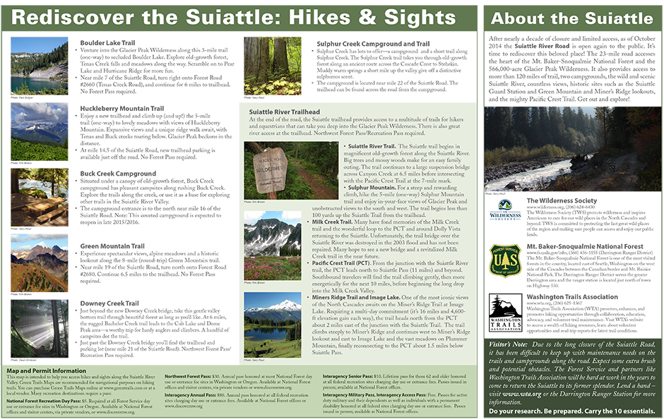
Rediscover the Suiattle
Celebrating the long-awaited reopening of the Suiattle Road, The Wilderness Society worked with the U.S. Forest Service and Washington Trails Association to develop a map featuring some of the best hikes and sights along the 26-mile Suiattle Road, which takes you to the heart of the spectacular Glacier Peak Wilderness.


View and save PDF version here
Join the movement
to save our wildlands